Epic Bicycle Rides - Corona Pass in Winter
I biked up Corona Pass on 1/1/2016.
What’s Corona Pass?
Corona Pass, also known as Rollins Pass, is a high-altitude mountain pass in north-central Colorado, between the towns of Winter Park and Nederland. Part of the Moffat Road, Rollins Pass was the first railroad passage over the Rocky Mountains, before the Moffat tunnel was opened in 1928. The pass was used by railroad traffic from the early 1900s through 1928, and then thereafter has been used mostly as an scenic automotive drive.
In the summertime, I bicycle up Corona Pass several times a season. It’s great to get above the tree-line on a bicycle, and the pass road itself has access to many great single-track trails such as Broken Thumb, Twisted Ankle, and Rogers Pass.
In the winter, the road turns into a snowmobile heaven. TheGrand Adventures company has the USFS permits for grooming much of the trails in the Fraser Valley, and Corona Pass is one of the major roads for their service (and for public use as well). As a result, it turns into a great road for fat biking in the winter. I’ve ridden this pass in Winter a couple of times each season, and it’s always been a blast.
The Plan
This ride had been my New Year’s Day plan for a while, but it almost didn’t happen. It got down to -20ºF overnight at my place, and in the morning it wasn’t really warming up. But, thanks to some weather sorcery, it was actually warmer closer to the mountains. I left 90 minutes later than planned - at 11:30am it was -11ºF at my place, and 15 miles away at the start of my ride it was a whopping 8ºF. Cold, but certainly bearable, especially on such a bright sunny day.
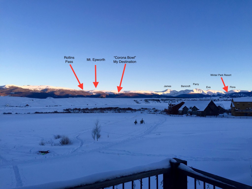 The Destination
The road was in great shape on the way up - groomed, snowmobiled, and packed in well.
On the way down, enough snowmobile traffic had come up during my ride that the snow was really chewed up. In some respects that made for a better descent, as I had to pedal just enough to keep my heart rate up and that kept me from freezing as much.
The ride up took 2hrs 50min to cover 9 miles, with 2200 ft elevation gain with a 4.4% average grade. The descent took just an hour.
This was the first time I made it all the way to the top of where the snowmobile traffic goes. What a great adventure, and great way to start 2016.
Scenes Along the Way
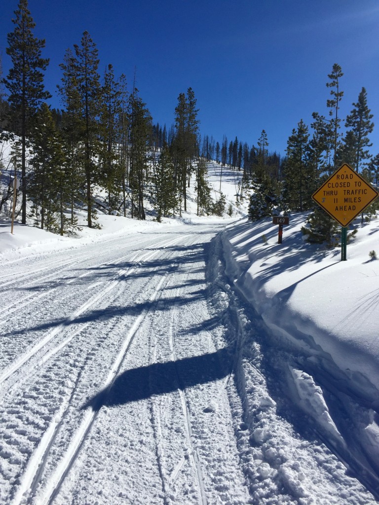 After a 3/4 mile climb over a rough snowmobile trafficked hill from the
parking lot, I wound up on
Corona Pass road. The Grand Adventures snowmobile rental company grooms the
main road regularly. It’s a gentle grade (~3-5%) and a relatively easy climb
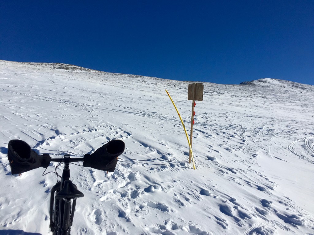
up. The road closed sign is because the Needle Eye tunnel, on the Front Range
side, collapsed years ago and they haven’t re-opened it yet. You can go all
the way up from Nederland, and all the way up from Winter Park, but you can’t
drive over - non-motorized traffic can make it over, though.
After a 3/4 mile climb over a rough snowmobile trafficked hill from the
parking lot, I wound up on
Corona Pass road. The Grand Adventures snowmobile rental company grooms the
main road regularly. It’s a gentle grade (~3-5%) and a relatively easy climb
up. The road closed sign is because the Needle Eye tunnel, on the Front Range
side, collapsed years ago and they haven’t re-opened it yet. You can go all
the way up from Nederland, and all the way up from Winter Park, but you can’t
drive over - non-motorized traffic can make it over, though.
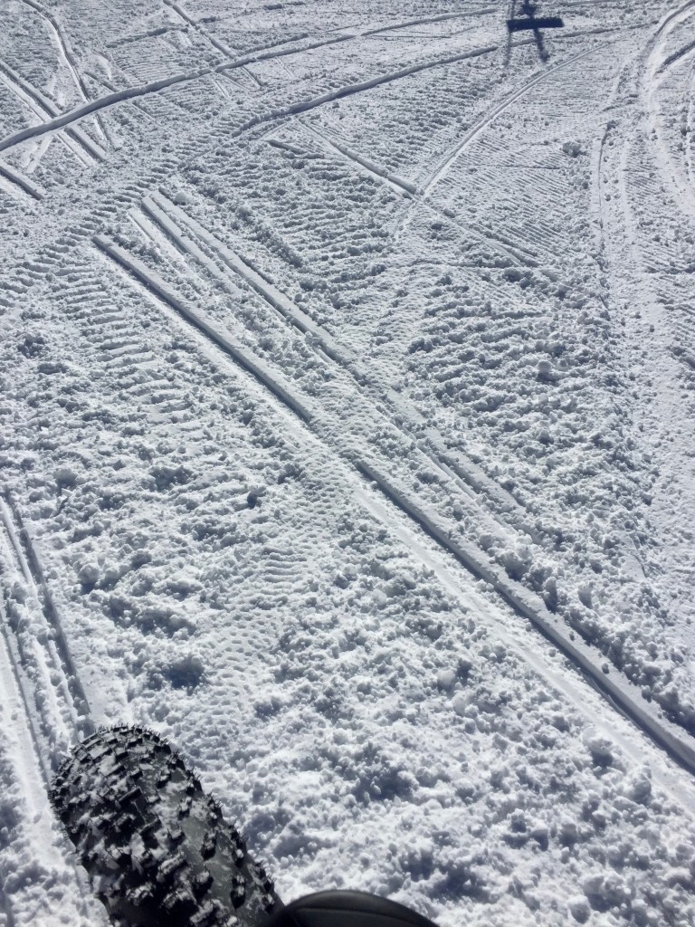 Only light tracks left on the super packed snow.
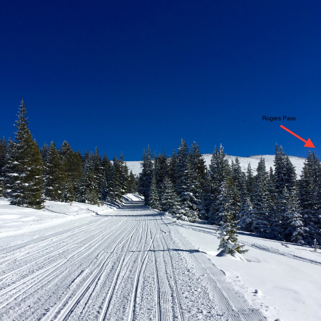 First big break with the treeline now closeby. Rogers Pass is in view, and
Riflesight Notch is just ahead.
First big break with the treeline now closeby. Rogers Pass is in view, and
Riflesight Notch is just ahead.
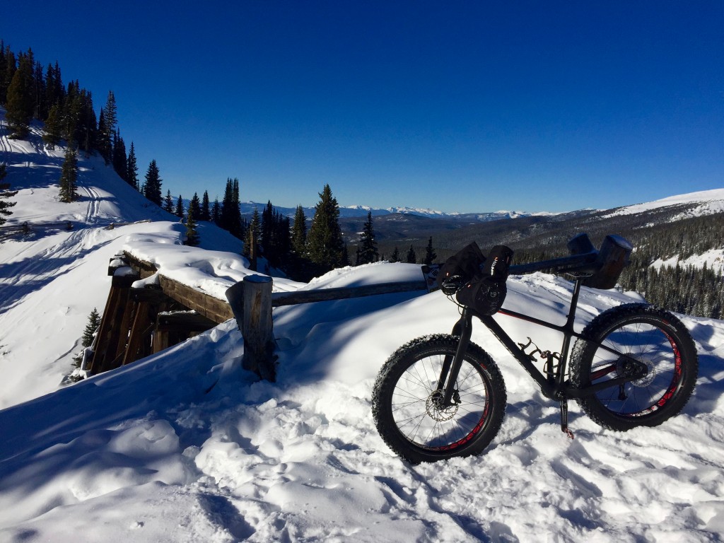
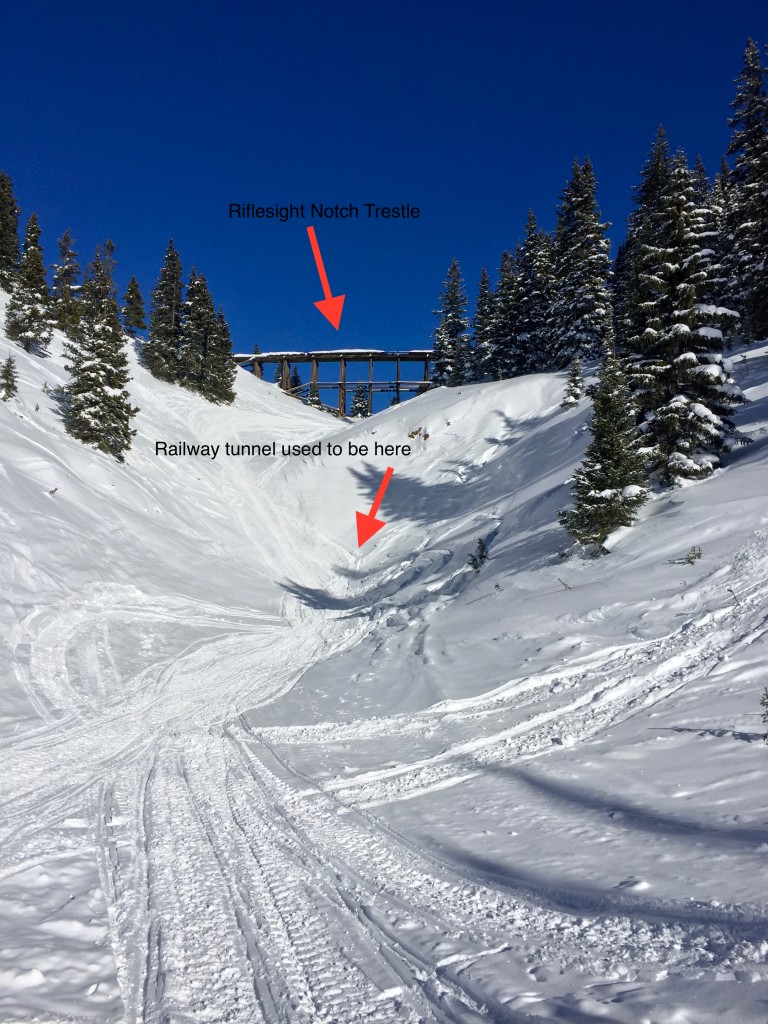 The famous Riflesight Notch railroad trestle. When the railroad ran, the
tracks would circle down the hill and then come out underneath the trestle
from a tunnel, hence the name.
The famous Riflesight Notch railroad trestle. When the railroad ran, the
tracks would circle down the hill and then come out underneath the trestle
from a tunnel, hence the name.
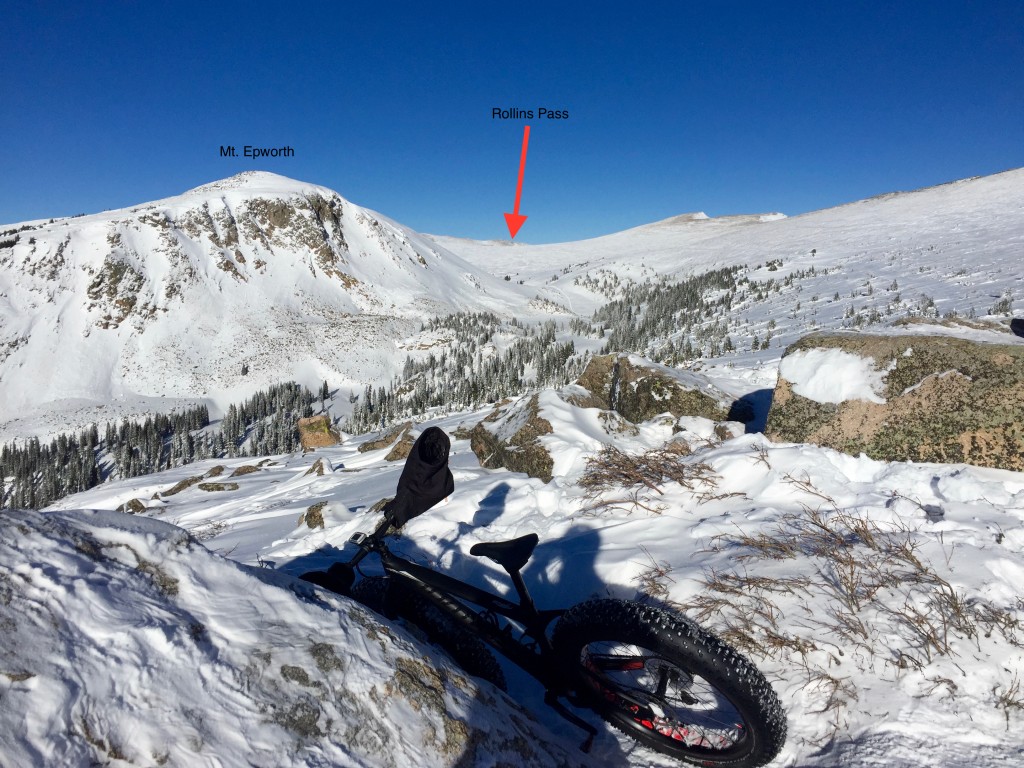
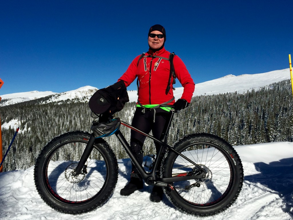 A friendly snowmobiler took my picture while next to the trestle. Mt. Epworth and my destination is
just behind me.
A friendly snowmobiler took my picture while next to the trestle. Mt. Epworth and my destination is
just behind me.
 Welcome to the tundra. I MADE IT! This is as high as I’ve been in in the
winter on any of my rides up here. Rollins Pass is about 2-3 miles in the
distance, but the road isn’t groomed in the winter (enough for me to make it
on a bike, anyway).
Welcome to the tundra. I MADE IT! This is as high as I’ve been in in the
winter on any of my rides up here. Rollins Pass is about 2-3 miles in the
distance, but the road isn’t groomed in the winter (enough for me to make it
on a bike, anyway).
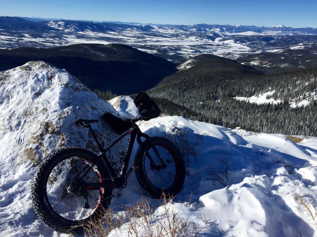
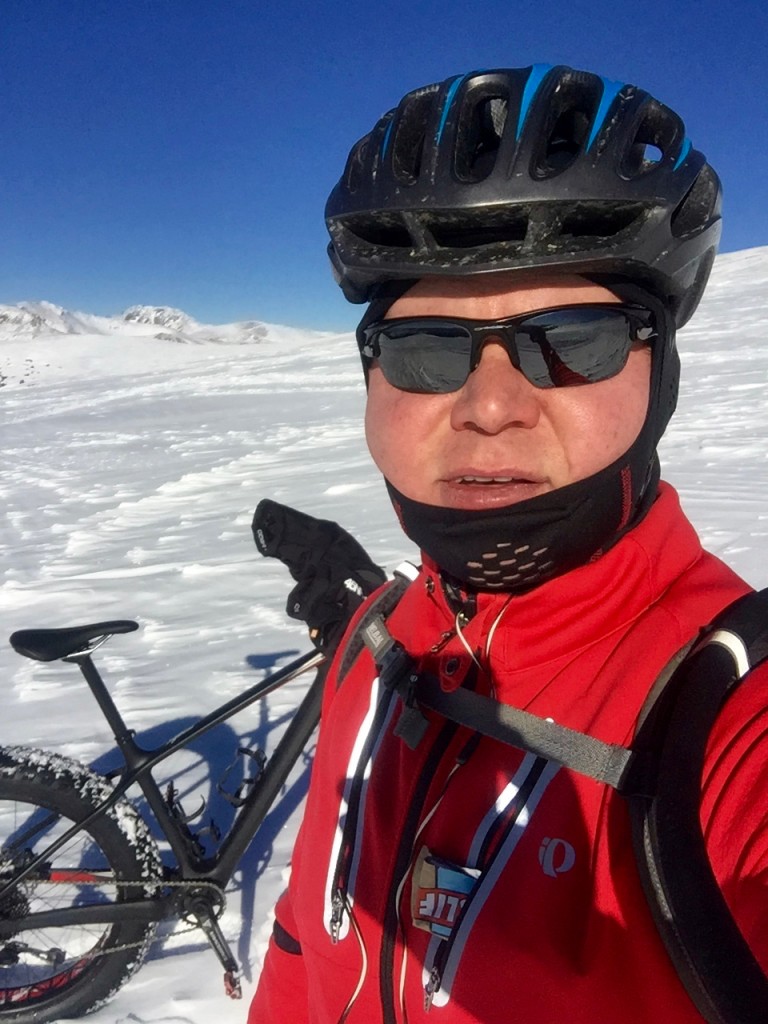 I’m still alive! Despite being very, very cold, there was no wind today -
absolutely none. It was awesome up top.
I’m still alive! Despite being very, very cold, there was no wind today -
absolutely none. It was awesome up top.
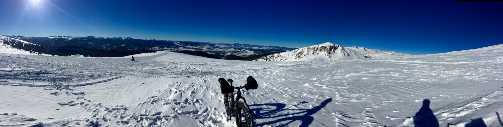 Gratuitous pano…
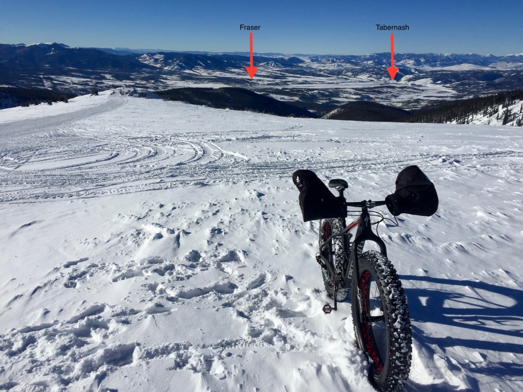 Looking down towards the Fraser valley from the top. You can see Fraser and
Tabernash (my place!) far below.
Looking down towards the Fraser valley from the top. You can see Fraser and
Tabernash (my place!) far below.
 And there’s the Continental Divide! Just a hundred yards or so away. On the
otherside is Nederland and then Boulder.
And there’s the Continental Divide! Just a hundred yards or so away. On the
otherside is Nederland and then Boulder.
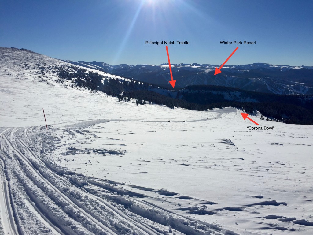
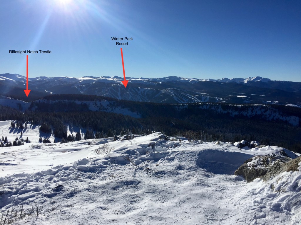 Looking towards Winter Park we can see the ski resort and the Riflesight Notch
railroad trestle where I just came from.
Looking towards Winter Park we can see the ski resort and the Riflesight Notch
railroad trestle where I just came from.
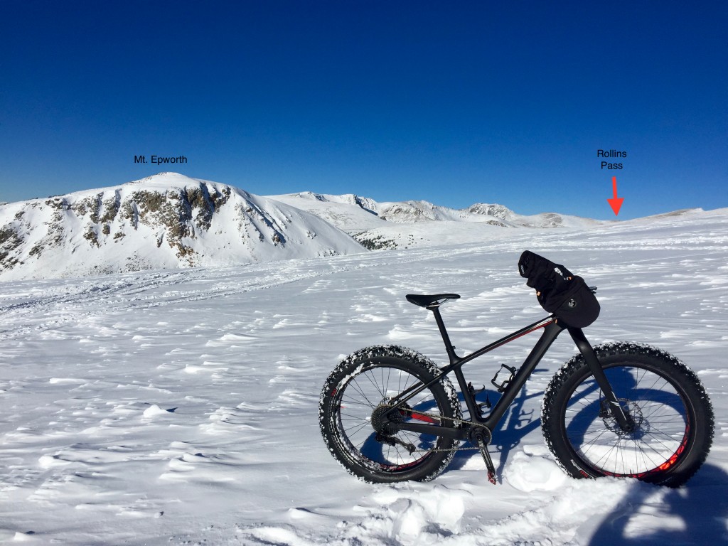
 Looking back towards the North we can see Mt. Epworth and Rollins Pass in the
distance. If you look closely, you can see snowmobile tracks the more advanced
riders have made over to that area.
Looking back towards the North we can see Mt. Epworth and Rollins Pass in the
distance. If you look closely, you can see snowmobile tracks the more advanced
riders have made over to that area.
 Further down the hill. In the summer, this rock is just above the main road.
The snowmobiles all wind up here for the scenic view.
Further down the hill. In the summer, this rock is just above the main road.
The snowmobiles all wind up here for the scenic view.
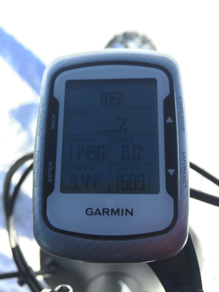 11,500 ft!
 About to descend… this hill, down towards Corona Bowl, was actually too
steep to ride up, so I hiked up. Coming down, a minute or so after this shot
was taking, I built up too much speed and had a spectacularly fluffy powder
crash. A little less air pressure in the tires would have helped
that…
About to descend… this hill, down towards Corona Bowl, was actually too
steep to ride up, so I hiked up. Coming down, a minute or so after this shot
was taking, I built up too much speed and had a spectacularly fluffy powder
crash. A little less air pressure in the tires would have helped
that…
 Back down at the Riflesight Notch railroad trestle… still early in the
season so it is visible.
Back down at the Riflesight Notch railroad trestle… still early in the
season so it is visible.